
Updated October 23, 2026: Checked current Route 8, 52, and 60 service references. Removed the incorrect Route 13 Ala Moana connection, unsupported fixed frequencies, protected-beach assurances, and the advice to skip a crowded bus without checking the next trip. Refreshed timetable and internal guide links.
Key Takeaways
- Pick one town and one beach. Fewer stops mean less stress and more sand time.
- Compare Route 52 via Wahiawa with Route 60 via the Windward coast. The quickest option depends on your departure and connections.
- Start early and watch the clock. Return rides are less frequent in the evening.
- Use a HOLO Card for transfers and fare caps. See our HOLO guide.
- Pack sandals, a small towel, water, and something dry for the ride back.
Niko’s Note 🐾 Screenshot the last Route 52 and Route 60 departures from Haleiwa before you leave Waikiki.
The Two Core Patterns
Option A: inland via Wahiawa
Waikiki → Ala Moana Center → Route 52 to Haleiwa
- Waikiki to Ala Moana Center on Route 8. Check the current timetable: Route 8 PDF.
- Route 52 toward Wahiawa and Haleiwa. Get off at or near Weed Circle for central Haleiwa. Timetable: Route 51 52 PDF.
- Walking radius covers Haleiwa Town, shave ice, and Haleiwa Beach Park.
Why choose it This is the inland option via Wahiawa. Compare the current trip plan for your departure rather than assuming it will always be faster.
Option B… Scenic coast
Waikiki → Ala Moana Center → Route 60 to Haleiwa
- Waikiki to Ala Moana Center on Route 8. Timetables above.
- Route 60 via Kaneohe and the Windward coast to Haleiwa. Timetable and map: Route 60 PDF · Route 60 HTML.
- Walking radius covers Haleiwa Town and a short hop to beaches north of town.
Why choose it Most scenic day with ocean views and small towns along Kamehameha Highway.
Note Some materials reference Route 55 for the Windward coast. The current published North Shore corridor is Route 60. If you see 55 on older maps, confirm the latest pattern on the Routes page. Links above.
Realistic Day Plan
Goal one town and one beach… then home for dinner. Adjust times by season.
| Time block | Move | Typical time | Details |
|---|---|---|---|
| 7:00 to 7:30 | Waikiki to Ala Moana Center | 15 to 25 min | Route 8 to Ala Moana Center Kona Street. Use HEA for the next bus. HEA |
| 7:40 to 9:20 | Ala Moana to Haleiwa (Option A) | 80 to 100 min | Route 52 via Wahiawa to Weed Circle. Published times and patterns: Route 51 52 PDF. |
| 7:40 to 10:10 | Ala Moana to Haleiwa (Option B) | 100 to 150 min | Route 60 via Kaneohe and coastal towns to Haleiwa. Published times: Route 60 PDF. |
| 9:30 to 11:30 | Haleiwa Town | Flexible | Coffee and strolls… art, surf shops, and food trucks near Kamehameha Highway. |
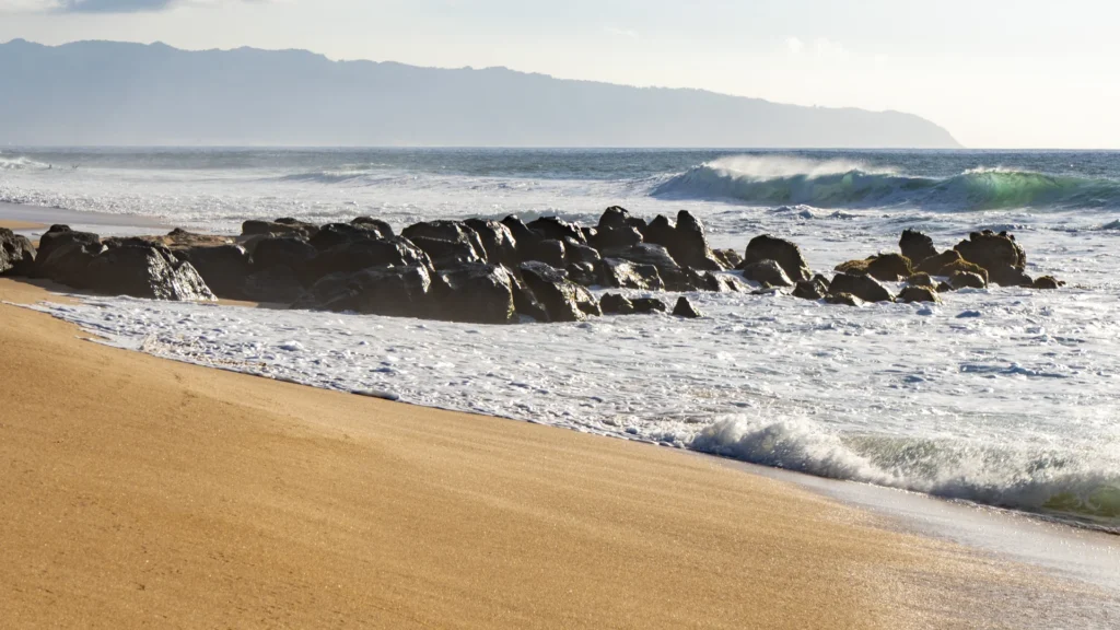
| 11:30 to 2:00 | Beach time | 20 to 120 min | Pick one… Haleiwa Beach Park for easy access, or hop north to Pua‘ena Point or Waimea Bay when conditions allow. Use HEA to time the short bus hops. |
| 2:00 to 3:00 | Lookout or treat | 30 to 60 min | Choose a last snack in town, with time to walk to your confirmed return stop. Keep an eye on return trips. |
| 3:30 to 6:00 | Return to Waikiki | 120 to 180 min | Reverse your morning pattern. Leave earlier if swell or traffic rises. |
Safety note North Shore surf can be powerful in winter. Obey posted warnings and lifeguards. If surf or warnings make the beach unsafe, stay out of the water and spend the time in town. A beach is not automatically safe because part of it looks sheltered.
Timing and frequency
Use TheBus current route index for your day’s departures. Route 8 links Waikiki and Ala Moana; routes 52 and 60 serve Haleiwa along different corridors. Short-turn trips may stop earlier, so read the destination as well as the route number.
The sample time blocks above are planning estimates, not measured trips or a timetable. Add walking, waiting, traffic, and transfers. Choose a return with another scheduled departure behind it, then use HEA for arrival estimates.
Map and Wayfinding
- Open the System Map PDF and zoom to the North Shore panel. Current system map.
- In Haleiwa, Weed Circle is the main loop for 52 and 60. Check stop labels in the timetable PDFs above.
- In Waikiki, the easiest transfer to 52 or 60 is at Ala Moana Center Kona Street… use the timepoint tables in each PDF.
What to Pack and Do
- HOLO Card with balance… see our HOLO guide.
- Sun protection… hat, reef safe sunscreen.
- Small towel and sandals… keep sand off seats.
- Water and light snacks… closed containers only per rules. Review TheBus rules.
- Respect… lifeguards and posted signs keep you safe. Leave no trace.
Leave a return buffer. A full bus can mean a long wait. Check the next scheduled trip before deciding to skip one. Do not build the day around the final bus.
Keep Planning
- Pillar: Oahu by Bus 2026 Guide
- Airport transfers: Honolulu Airport to Waikiki… Bus vs Rideshare
- Compare driving vs transit: Bus vs Rental Car in O‘ahu… Cost, Stress, Parking
- Glossary: O‘ahu Transit Glossary… HOLO, OTS, Routes
FAQ
Is there a direct bus from Waikiki to Haleiwa No direct bus from central Waikiki. Transfer at Ala Moana Center to Route 52 or Route 60. See the Routes page and PDFs above.
Which is faster, 52 or 60 Route 52 takes the inland corridor through Wahiawa; Route 60 follows the Windward coast. Compare the complete journey in the current timetable, then use HEA for arrival estimates.
Can I visit multiple beaches in one day by bus It is possible, but you risk spending more time waiting than swimming. Choose one main beach and leave time in town.
What about Route 55 Older guides list Route 55 along the Windward coast. Check the current Routes page… the corridor is now covered by Route 60. Confirm patterns before you go.
What if the surf is huge Stay out of the water when conditions are unsafe and spend more time in Haleiwa Town. Safety first.
Sources
- TheBus… Routes and Timetables index with current PDFs and HTML pages: thebus.org/route/routes.asp
- Route 51 52 combined timetable with current North Shore access via Wahiawa: thebus.org/route/Timetables/Rt51-52.pdf
- Route 60 timetable and HTML overview for the Windward coast to Haleiwa: thebus.org/route/Timetables/Rt60.pdf · thebus.org/route/HTMLversion/Rt60_new.htm
- Route 8 Waikiki to Ala Moana frequent shuttle… current timetable: thebus.org/Route/timetables/rt8.pdf
- System Map to visualize the day: thebus.org/SystemMap/SystemMap20240814.pdf
Accurate as of October 2026.
Found an error or an outdated detail? Send a correction for this article.